
Group Riding
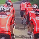
Group Riding Conduct and Etiquette
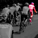
Concentrate: Pay attention to signals and the world around you
Communicate: Signal your intentions and call out hazards
Co-operate: Work together to make the ride enjoyable and safe
Club Rides are not races and members are expected to treat them appropriately. In order to ensure that rides remain safe as well as good fun, it is important that everyone follows a set of rules. The Club is not responsible for your safety; everyone on the ride must be responsible for their own safety, and, by their behaviour, ensure the safety of other Club members. Always bear in mind that not everyone in the group may be as confident or have as good bike handling skills as you.
Please follow these guidelines to keep yourself and your Club-mates safe. Actively encourage fellow riders to follow these guidelines during every ride.
Be considerate to other road users and uphold the reputation of your Club.
Signals
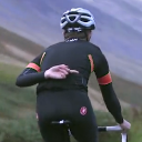
Ride Leader Guidelines
All West Suffolk Wheelers rides should have a ride leader; some rides have a rota, some designate a leader from those that attend. The ride leader’s job is to guide the group around the chosen route and act as a point of contact for participants.
As ride leader you are the club’s designated representative and have club approval to manage the ride and ensure riders follow the Group Riding Conduct and Etiquette guide. Your decisions must be respected.
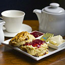
Cafe Guide
Need to find a café for your weekend ride? Then the West Suffolk Wheelers Café Guide is your salvation. Whatever point of the compass you're heading to from Bury St Edmunds and whatever distance you plan to ride, there's a café for you. Click on the café to find out how big it is, whether there is outside seating and bicycle parking.
If you spot any errors here or have found a new cafe you think we should try, then email admin@westsuffolkwheelers.org
Route Guide
Below are routes to some of our favourite cafés. Click the link next to the map to view a route on Strava.
Why not install all the routes on your Garmin/GPS device so you always have a ready route for a club run? You can download all the routes in a single zip file by clicking one of the links below (TCX files are best for most devices, if they don't work, then try the GPX):
- All Routes TCX : WSWroutePack18TCX.zip
- All Routes GPX : WSWroutePack18GPX.zip
Once downloaded, unzip the folder and then copy the files to your device (refer to your manufacturers instructions, or google it, if you don't know how to do this. For Garmin devices it usually means copying files into the NewFiles folder on your device).
Beehive - Blo Norton
Distance: 48 miles
Elevation: 1500 ft
Direction: NE
Strava Route: Click Here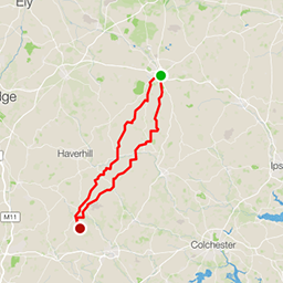
Blue Egg - Great Bardfield
Distance: 62 miles
Elevation: 3300 ft
Direction: SW
Strava Route: Click Here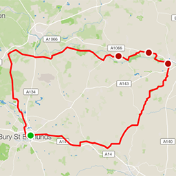
Bressingham or Angel - Diss
Distance: 58 miles
Elevation: 1900 ft
Direction: NE
Strava Route: Click Here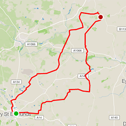
Café Cadence - Old Buckenham
Distance: 59 miles
Elevation: 1900 ft
Direction: NE
Strava Route: Click Here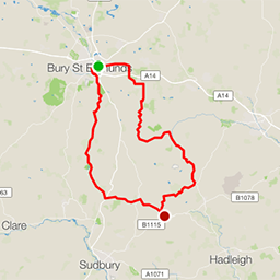
Café Como - Brent Eleigh
Distance: 38 miles
Elevation: 1500 ft
Direction: S
Strava Route: Click Here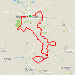
Café Como "Ciclitalia" - Brent Eleigh
Distance: 49 or 61 miles
Elevation: 2400 ft
Direction: S
Strava Route: Click Here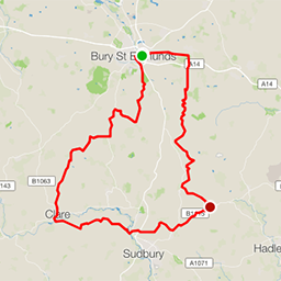
Café Como (via Clare) - Brent Eleigh
Distance: 53 miles
Elevation: 2300 ft
Direction: S
Strava Route: Click Here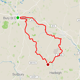
Hollow Trees - Semer
Distance: 45 miles
Elevation: 2000 ft
Direction: SE
Strava Route: Click Here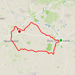
La Hogue - Chippenham
Distance: 43 miles
Elevation: 1700 ft
Direction: W
Strava Route: Click Here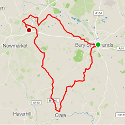
La Hogue via Clare - Chippenham
Distance: 55 miles
Elevation: 2200 ft
Direction: W
Strava Route: Click Here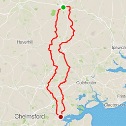
Lock Tearoom - Heybridge Basin
Distance: 99 miles
Elevation: 4400 ft
Direction: S
Strava Route: Click Here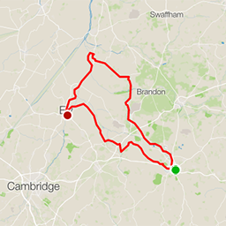
Peacock Tearoom - Ely
Distance: 75 miles
Elevation: 1700 ft
Direction: NE
Strava Route: Click Here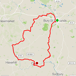
Platform One - Clare
Distance: 52 miles
Elevation: 2400 ft
Direction: SW
Strava Route: Click Here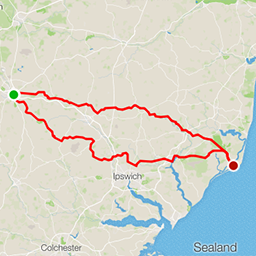
Riverside Tearoom - Orford
Distance: 94 miles
Elevation: 3600 ft
Direction: E
Strava Route: Click Here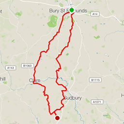
Spencer's Fruit Farm - Wickham St Paul
Distance: 50 miles
Elevation: 2700 ft
Direction: S
Strava Route: Click Here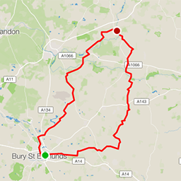
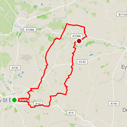
St George's Distillery - East Harling
Distance: 49 miles
Elevation: 1600 ft
Direction: NE
Strava Route: Click Here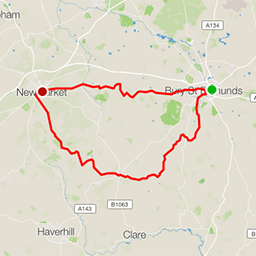
Tack Room - Newmarket
Distance: 42 miles
Elevation: 2200 ft
Direction: W
Strava Route: Click Here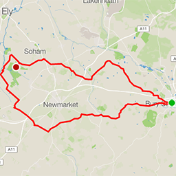
Wicken Fen - Wicken
Distance: 56 miles
Elevation: 1700 ft
Direction: W
Strava Route: Click Here